


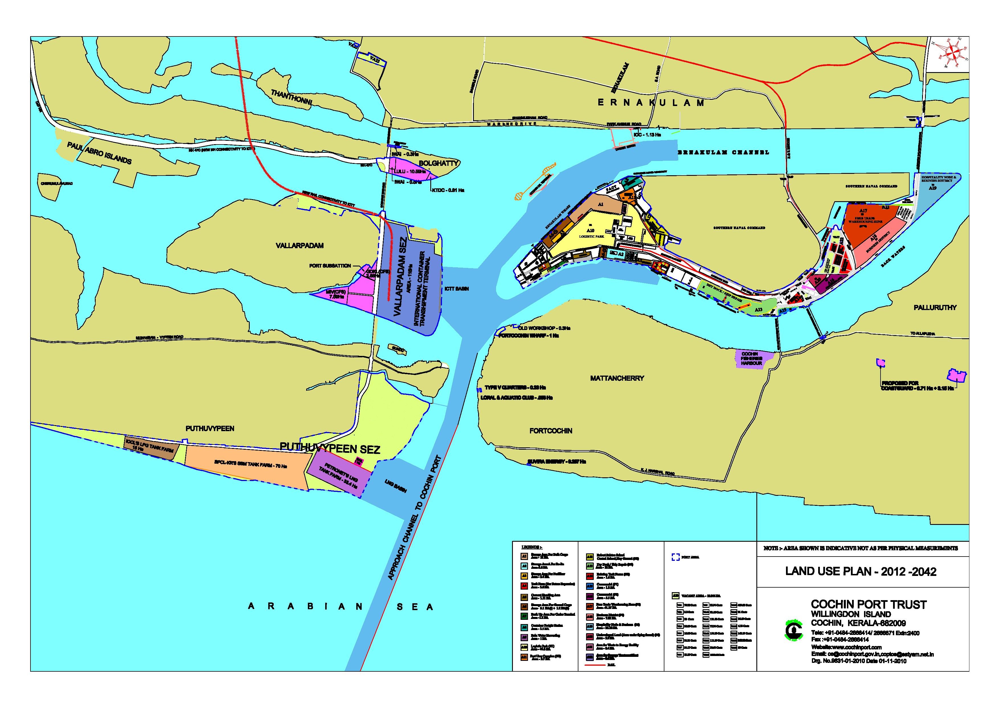
Cochin Port Authority has about 881.43 ha (2177.14 acre) of land at various locations in Ernakulam District, which include Willingdon Island (879.80 acre), Vallarpadam and Bolgatty (502.27 acre), Puthuvypeen (762.43 acre), Ernakulam (18.1 acre), Fort Kochi (4.76 acre) and Palluruthy (9.79 acre).
Land Use Plan for Cochin Port
Cochin Port Authority has formulated a Land Use Plan for all the land belonging to the Trust.
The Land Management of Cochin Port Authority is guided by the Policy Guidelines for Land Management by Major Ports (PGLM), 2015, effective since 02.01.2014, issued by the Government of India.
Click here to download PGLM, 2015
PGLM aims to ensure optimum use of land resources as per the approved Land Use Plan of the Major Port with focus on retaining/ attracting port traffic, and optimum value realization through a transparent tender-cum-auction methodology. The Guidelines also permit Major Ports to allot land on nomination basis to Government Departments/ Organizations.
PGLM aims to ensure optimum use of land resources as per the approved Land Use Plan of the Major Port with focus on retaining/ attracting port traffic, and optimum value realization through a transparent tender-cum-auction methodology. The Guidelines also permit Major Ports to allot land on nomination basis to Government Departments/ Organizations.
Renewal of leases is also considered on merit.
Click here to download format of application for Renewal of lease of land
Cochin Port Authority conducts its Land Management through an ERP based computer system, where billing and recovery of payments are done through a Real Estate Management (REM) module.